


Mġarr & Surroundings
A walk round Bella Vista Apartments will reveal a quaint, rural village with a surprising number of restaurants encircling a magnificent church. Ready made delicious food can be found all day long, from as early as 06.00 hrs to late at night. On the village outskirts one finds an abundance of fertile fields surrounded by the traditional rubble walls. These walls distinguish between one field and another as well as provide shelter for crops and prevent soil erosion when it rains. They are especially practical when it comes to terraced fields, and nowhere is this more evident than in the beautiful countryside surrounding Mġarr.


History of Mġarr – Early Years
People have lived in Mġarr and its surrounding countryside since Neolithic times. They took advantage of the high position, the fertile countryside and the surrounding bays. The first evidence of humans in the area are actually the Neolithic temples, namely Skorba (4500 B.C. – 4100 B.C.).
Skorba are found at Żebbiegħ in Mġarr. This period is known as Grey Skorba because of the colour of the pottery that was found which dates to these times. At Skorba, apart from the remains of a temple, the remains of foundations of what could have been huts have been found. This is where the people probably lived, these huts are likely to have been roofed over with clay. Some people believe that this site (Skorba) is even older than the Pyramids of Egypt.

Sometime between 3800 B.C. and 3600 B.C. the Ta’ Ħaġrat Temples at Mġarr were built. At these temples there is a Trilithon Entrance which is still intact. A tiny model of a temple was found at the Ta’ Ħaġrat Temples. Since this model was roofed over, it has been suggested that these and other Temples were roofed. However, although corbelling was found, it is possible that only the apses were roofed, possibly with animal skins.
The shape of the apses of Ta’ Ħaġrat Temples suggests that the people who built them believed in God’s providence. To them, fertility did not only mean the number of children they would have, but also the amount of produce they should harvest, as well as how much it would rain etc.…
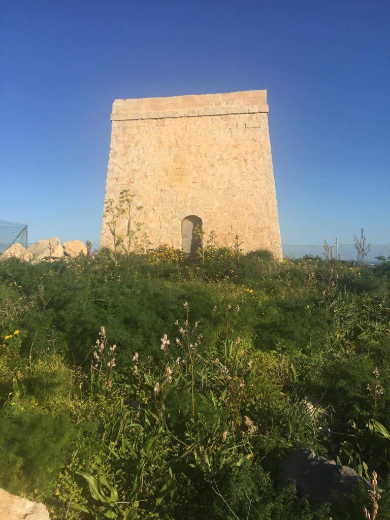
Huge stones also exist in the limits of Castello Zammitello. These are shaped in a circle.
Many other prehistoric remains have been found in the surrounding areas. This shows that the area was probably quite well populated and used during Neolithic Times, the Temple Age, as well as during the Bronze Age.
The many natural springs in the area must surely have contributed to the decision of the people of those times to settle down in the area.
Bronze Age remains were found between Ġnejna and Għajn Tuffieħa, as well as on Ras il-Ġebel. These people used to live in places where three of the sides were sheltered by the cliffs and they would then build a sort of fourth wall to shelter themselves. Cart ruts dating back to these years are also to be found in the vicinity of Mġarr, namely at Qala’ tal-Pellegrin, at Palma and Ta’ Mrejnu and also near Nadur Tower.


Punic Times
During Punic Times it is thought that extensive use was made of Mġarr and its surroundings. This is confirmed by the large number of tombs that have been found in numerous areas, among them at T’Abbatija, several near Skorba, some near the school at Mġarr, several in private houses. Another five tombs were found in the place where the Parish Church stands today. They had to be buried.
Several tombs were found in the area of Binġemma. Since they are different to each other it is thought that they were built over many years, probably from the time of the Phoenicians to the times of the Romans. It is also thought that some of these tombs were used as Catacombs by the Catholics.
However the most important building dating back to these times is probably the Roman Villa and Baths found at Għajn Tuffieħa, which was probably built on a site which had already been used earlier by other people. This is known from the several remains which were discovered in the area when excavations were carried out around 1920. The natural springs that were found in the area probably contributed to this sort of building i.e. Baths.
Later years and the Knights of St John
It is thought that the Bays of Fomm ir-Riħ, Ġnejna and Għajn Tuffieħa were used for mercantile activities up to, during and even after the times of the Arabs. Since the area was so busy, it was guarded by the Militia (1417). This guard was provided by Towers built for the purpose by the Aragonese, as well as farm houses which were built on high grounds.
Several Towers were rebuilt or restored by the Knights of St John. One was at Għajn Tuffieħa, one at Lippija and another at Fomm ir-Riħ. To give warning a fire would be lit on the tower, the smoke of which would be seen from the next tower. The guard on this would in turn light another fire and so on, so that people would see them, be warned, and flee to Mdina for safety behind its bastions.
The British Era
When the British came to Malta, they reinforced the fortifications left by the Knights of St John. Several towers were built on what the British called the Great Fault. This is a great cliff crossing the island from east to west, a natural inland cliff, which however needed to be reinforced by fortifications in case of attack.
This project was called the North West Front and commenced in 1875. Three strategic places were chosen, one of which was Binġemma. A long, deep trench was dug in the limits of Dwejra called Dwejra Lines. A long wall was built, behind which soldiers could stand and shoot.
Dwejra lines are a section of the Victoria lines. Victoria lines span 12 km along the width of Malta. They run along a natural geographical barrier known as the Great Fault , from Madliena in the east, through the limits of Mosta, to Binġemma and on to Rabat, on the west coast. A unique monument of military architecture.
When hiking you will get a fine view and many superb scenic photos may be shot along your trek.
Between 1875 and 1887 another fortification was built, Fort Binġemma. Its entrance is hidden and its tower was built in the form of a diamond in concentric ‘circles’.
Because of its strategic position, Malta was a vitally important colony of the British during the Second World War. It had several airfields, thus becoming a target. Many people who lived close to these airfields and/or harbours moved to safer locations – one of which was Mġarr.
Another structure was being built in Mġarr – Shelters! Once again, the area of Mġarr was being dug, not to bury their dead now (as in the time of the catacombs) but to try and stay alive!
Several shelters were built in the area. Around 30 shelters were dug. Some of these led to one another. Some were small, while others were quite large, consisting of tunnels with small rooms dug into their sides. One of these – quite a large one – is found underneath a restaurant in Mġarr. It has been restored and is open to the public. (http://www.historvius.com/mgarr-second-world-war-shelter-522/)
These shelters provided safety during the air raids. Should the street/house on top be hit by a bomb, the people would be safe underground. During the night, most of the people used to sleep in these shelters.
Malta was heavily bombed. In 1942 the island was awarded the George Cross to ‘bear witness to the heroism and devotion of its people’. The George Cross is woven into the Flag of Malta.


A rich heritage in the NORTH OF MALTA
Churches and Chapels
The church was blessed on 13th August, 1939, just a few weeks before the beginning of the Second World War.
Over the years Mġarr has had many churches and chapels, some of which still exist. Mġarr Parish Church The Parish church of Mġarr was built on the plans of Gio Maria Camilleri (the architect, not to be mixed with Gio Maria Camilleri the Builder, who finished the dome of the church). The first stone was laid on 2nd June, 1912. This church took many years to build. Work was postponed many times, usually because of a lack of funds. When it came to the dome, the architect of the time resigned as he refused to take responsibility for the project. Mr Ġanni Cilia – a mathematician – was roped in and asked to make studies on how to build this dome. In the evening Mr Cilia used to meet up with Gio Maria Camilleri the master builder.
Together they drew the dome on the school grounds. They then proceeded to build the dome on the parvis of the church. All these difficulties arose as the dome is not circular but oval. Thus many of the stones needed to be of a different shape. The church was blessed on 13th August, 1939, just a few weeks before the beginning of the Second World War. Incidentally, Gio Maria Camilleri (the Builder) happens to be the grandfather of the owner of these apartments.
Żebbiegħ Church In 1974, a group of people donated a piece of land on which the church of Żebbiegħ was to be built. It took 12 years of planning and discussion before work started. The first stone was laid by Archbishop r Giuseppi Mercieca on Sunday, 20th November, 1987, exactly 75 years after the first stone of the Mġarr Parish Church was laid. The Church of Żebbiegħ is dedicated to St Anna. Binġemma Chapel The chapel at Binġemma is dedicated to the Holy Virgin of Itria (Itria is a place near Constantinople). This graceful church is perched on the edge of the rocky side of the very picturesque valley down which the road descends from the heights of Binġemma to Mġarr. It was built in 1690. Today it stands there dreaming nostalgically of times gone by, and the labour, life and pastimes it has seen in this valley over many hundreds of years.